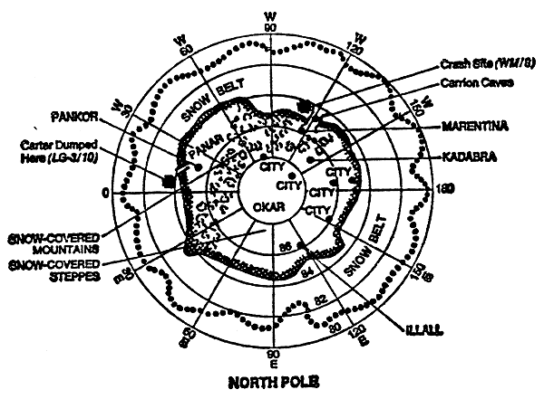
Maps of Barsoom

These maps show the surface of Barsoom. It should be noted that while the area of Mars is more like one-fourth that of Earth, its land area is almost 8 million square miles greater. This is because it has no great bodies of water, its largest ocean being entirely subterranean. Barsoom is a dying planet, its great oceans having dried up over a half-million years ago, their last legacy being the Great Toonolian Marshes. The dry sea-beds are now covered with ocher, moss-like vegetation and its ancient cities home to the wandering bands of green-skinned Martians. The cities of today are cast about the ruins of the past and they are spread far and wide through the thinning surface air of a dying world.
To view information about a location, click on it and then use your browsers back button to return.
 
  
Basoom's north polar region is cold, desolate, and snow-covered. It is isolated from the rest of the world by barren granite hills and a mighty ice barrier, which prevent any traffic other than by air. The only exceptions are the Carrion Caves that lead to the land of Okar and the corridor that leads through the fallen blocks of ice and rock to the city of Panar.

The south Pole is surrounded by the Otz Mountains, the Golden Cliffs and the southern ice fields, the only entrance aside from air being the dreaded River Iss, the River of Death. Home to the the Holy Therns and the black-skinned First Born, it is also home to Barsoom's only large body of water on the surface, the Lost Sea of Korus, nestled in the lush Valley Dor.

 
To see larger maps of the East and West hemispheres, click here.

Questions/Comments

« Back